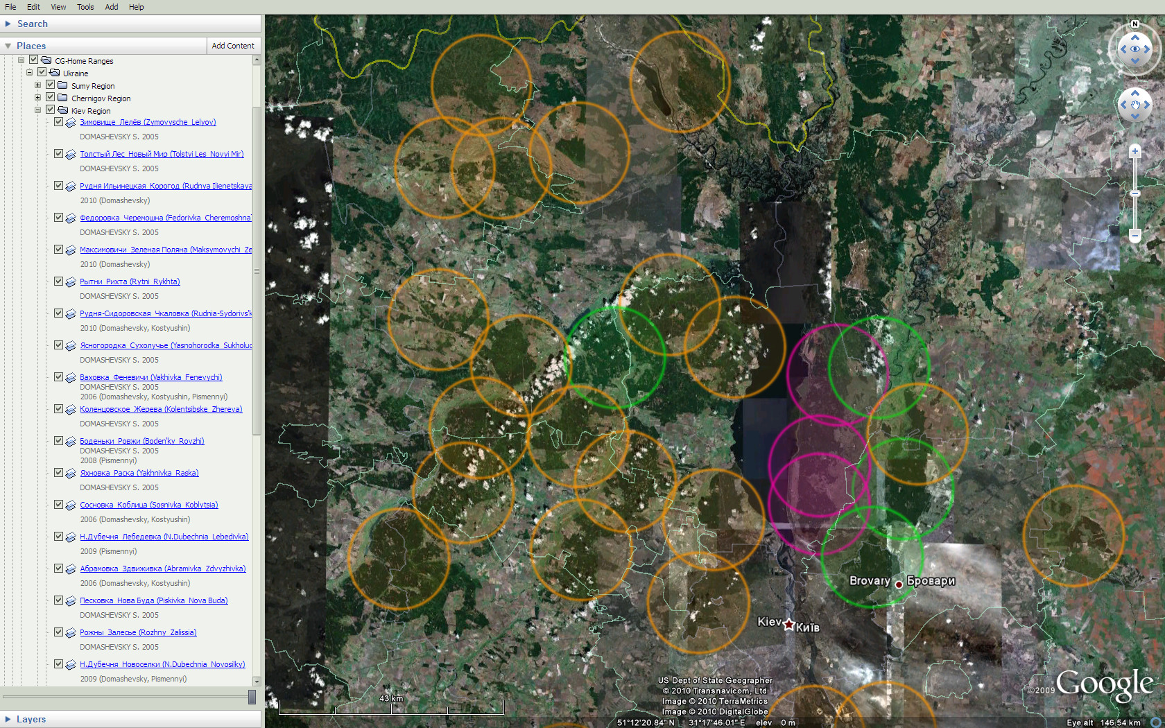
Home Ranges Map
This map is based now, as an example, on Sergey Domashevsky’s article of 2005, his and Vasilij Kostyushin’s later data and results of my observations. The data is not older than 20 years. During this period Short-toed Eagle habitats in northern Ukraine have not been transformed too much. Thus we can expect to meet them again at the same places, except areas where absence of the Eagles has been already confirmed. Such areas aren’t marked on the map.
When other sources are used they will certainly be mentioned here.
If you want to add locations of territorial Short-toed Eagles, you can open our and can do following steps:
– save the file on your computer;
– open it with Google Earth;
– Copy and Paste any location in the CG-Home Ranges folder;
– open Properties of the coppied location and move the coloured circle to your place;
Important: centres of the circles have not to correspond strictly to locations of Short-toed Eagles’ nests ! This is necessary to avoid excessive disturbance of the birds.
– rename the location and add the Description (source of the data, observer’s name, date of the first observation or something else);
– click OK to save the Properties and to close them;
– after saving all of your locations please save the file and
Diameter of the coloured circles is about 20 km – usual size of Short-toed Eagles hunting territories in Kiev Polesie and also it is useful for visual distance estimation.
Images of the circles can be viewed here: /wp-content/maps/CGHR.png. Red circle …/maps/CGHRf.png corresponds to a failed breeding attempt for the pair in the last season; green one …/maps/CGHRs.png corresponds to successful breeding (…/maps/CGHR~f.png and …/maps/CGHR~s.png – fail and success with high probability); and this one …/maps/CGHRp.png may be used for marking points of observations of Short-toed Eagles in their hunting territories.
Leave a Reply
You must be logged in to post a comment.